Water Resources Potential Map

Note:
For using river water, all types of data need to be collected and if found suitable then treatment option shall be used
Updated on :
Abbreviation Note:
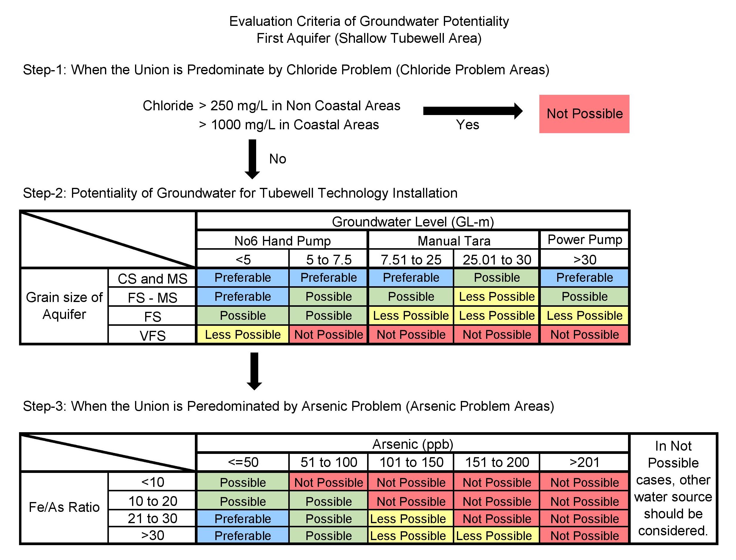
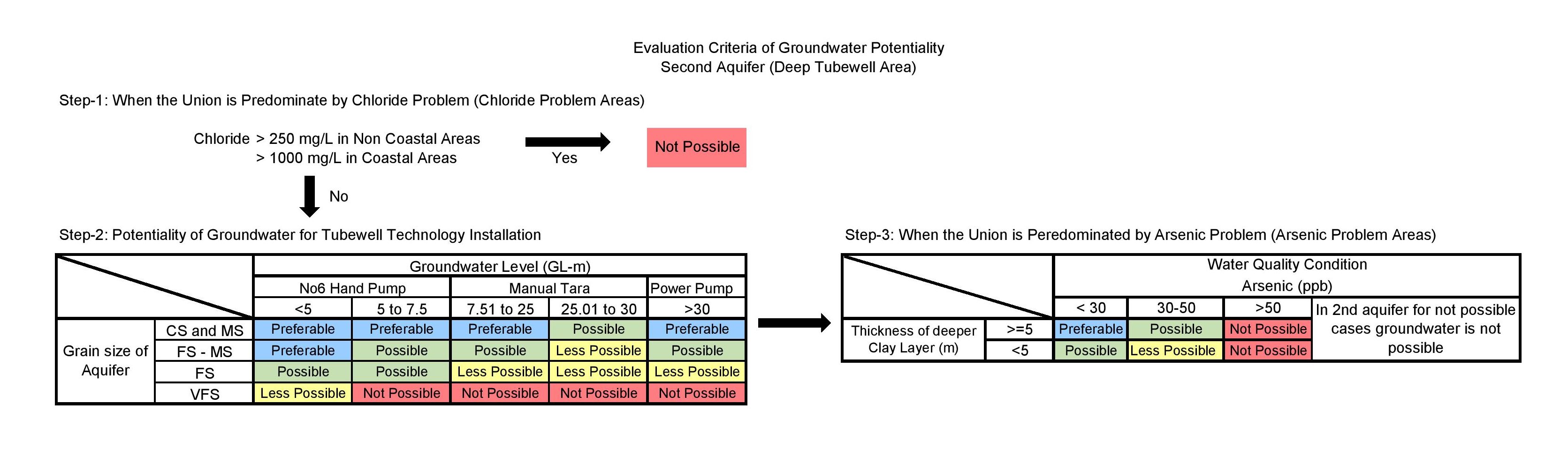
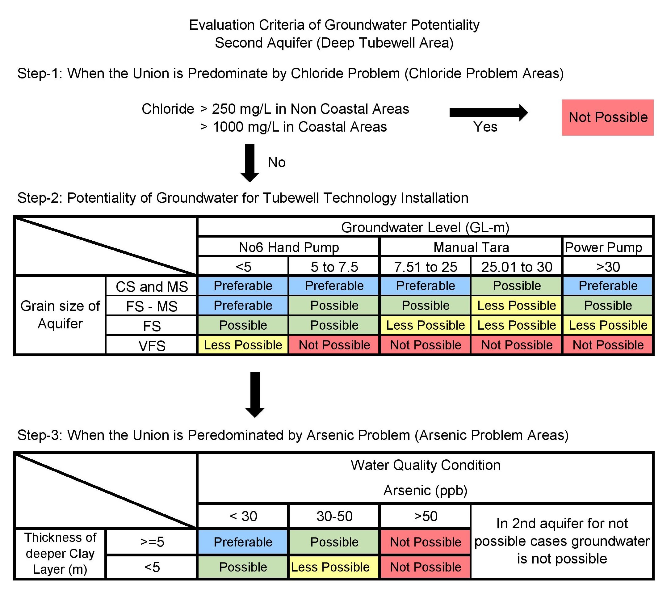
No.6= TW with No.6 (STW=Shallow Tubewell, DTW= Deep Tubewell), MT= Manual Tara (STW-Tara= Shallow Tubewell with Tara Pump/Dev head Pump, DTW-Tara=Deep Tubewell with Tara Pump/Dev head Pump), PP= Power Pump (STW-PP = Shallow Tubewell with Submersible Pump. DTW-PP=Deep Tubewell with Submersible Pump), ART= Arsenic Removal Technology, AIRP= Arsenic Iron Removal Plant, IRP= Iron removal Plant, PSF=Pond Sand Filter, NA=Not Available, ND=No Data, GWT=Groundwater Table.
Legend
| River Data | ||||||
|---|---|---|---|---|---|---|
| River Name | Station Name | DO Min(mg/L) | DO Avg (mg/L) | BOD Max (mg/L) | BOD Avg (mg/L) | Exploitable Flow (m³/s) |
| Groundwater Data | |||||||||||||
|---|---|---|---|---|---|---|---|---|---|---|---|---|---|
| Union | Grain Size | GWL (GL-m) | As (mg/L) | Fe (mg/L) | Cl (mg/L) | Evaluation | Tech. Option | Depth (m) | Remarks | Suggestions | |||
| Med | Max | Med | Max | Med | Max | ||||||||
[Note: Med = Median, Max = Maximum]